
Smarter Wildfire Response

Extreme heat is changing the security profile of summer. What was once treated largely as a seasonal civil protection issue is becoming a test of national resilience, urban governance and operational coordination. Fires now threaten not only forests and rural communities, but also transport corridors, hospitals, power networks, industrial sites and densely populated urban fringes.
In 2024, at least 13.5 million hectares of forest burned globally, making it the most extreme year for forest fires on record and surpassing the previous high of 2023 by around 13%. In Europe, 2025 became the most destructive wildfire season recorded in the EU, with more than one million hectares burned across 25 Member States. By 24 June 2026, the EU had already recorded 921 fires and 108,709 hectares burned, more than double the long-term average number of fires for the same period.
From Heat Maps to Predictive Public Safety
Predictive policing in the context of heat-risk hotspots is less about crime forecasting than about public safety deployment. The same analytical logic used to anticipate crowding, congestion or disorder can be redirected towards evacuation routes, vulnerable neighbourhoods, ignition-prone areas and critical sites exposed to cascading disruption.
AI models are increasingly able to combine meteorological data, vegetation dryness, land use, previous fire history, road access, population density and emergency response times. When overlaid with heat alerts, hospital capacity and mobility data, these systems can help authorities decide where patrols, fire crews, civil protection teams and public information units should be positioned before a crisis escalates.
The operational value lies in minutes. Early warnings allow police to close roads before smoke reduces visibility, municipal authorities to open cooling centres, and fire services to pre-position crews near likely ignition zones. They also help emergency planners identify where evacuation may be complicated by elderly populations, informal settlements, schools, campsites or industrial hazards.
Drones, Cameras and AI Fire Detection
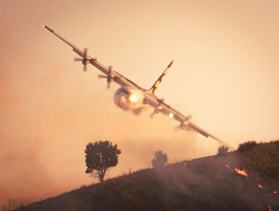
The most visible shift is in detection. AI-equipped cameras, satellite systems and thermal drones are being deployed to identify smoke plumes, heat anomalies and fire movement before emergency calls confirm an incident. The World Intellectual Property Organization has highlighted AI-powered satellites, thermal drones, digital twins and sensors as part of a new generation of wildfire technologies.
These tools do not replace firefighters. They extend the field of vision. Drones can inspect terrain that is too dangerous for crews, detect hotspots after apparent containment and provide live imagery to command centres. AI can sift through large visual streams, flag anomalies and prioritise alerts for human verification. In fast-moving fires, that combination can reduce uncertainty at the critical moment when commanders decide whether to attack, defend or withdraw.
Research is also pushing towards more dynamic modelling. A 2025 study using Meteosat Third Generation satellite data explored how fire arrival times, rate of spread and burnt area dynamics could be monitored at high frequency, offering a potential route towards near-real-time operational support. Such systems remain dependent on data quality, validation and trained decision-makers, but they point to a future where fire behaviour is not simply observed from the ground, but continuously modelled from above.
Firefighter Safety and Global Capacity
Firefighting capability is expanding, but unevenly. The United States had just over 1.01 million firefighters in 2023, while the National Fire Protection Association estimated 53,575 municipal firefighter injuries in 2024. In France, 91,000 of the country’s 258,641 firefighters are now trained in forest fires, a 10% increase over five years, as authorities prepare for higher-risk seasons.
Air assets are also being reinforced. For summer 2026, the EU announced its largest wildfire response capacity, with 777 firefighters pre-positioned across high-risk countries and 22 firefighting aircraft plus five helicopters ready for deployment. Canada has invested C$316.7 million, around €216 million, over five years to establish a national aerial firefighting surge capacity, including 10 aircraft and two support assets for the 2026 season. Australia’s National Aerial Firefighting Centre contracts 175 aircraft on behalf of state and territory governments, with more than 500 aircraft available across the country when additional state and operator capacity is included.
However, capacity is not only measured in aircraft and personnel. It depends on interoperable communications, shared maps, common evacuation protocols and the ability to move resources across borders. As fire seasons overlap between hemispheres and regions, leasing aircraft or borrowing specialist crews becomes more difficult. This makes predictive planning and early intervention more important.
Coordinating Police, Civil Defence and Local Authorities
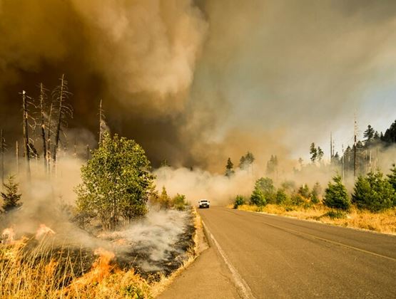
The management of a heat-driven fire emergency is a multi-agency operation from the first alert. Fire services suppress and contain. Police manage access, evacuations and public order. Civil defence coordinates shelters, medical support and logistics. Local authorities communicate with residents, protect utilities and support vulnerable people.
AI can strengthen this coordination when it produces a common operating picture rather than isolated dashboards. A shared platform can show fire spread, blocked roads, hospital locations, school closures, drone feeds and evacuation zones in one view. It can also support targeted public messaging, warning one district to prepare, another to evacuate and another to avoid a transport route.
The use of these technologies also brings operational and governance considerations. Predictive tools are only as reliable as the data and models behind them, while drone surveillance over populated areas requires clear rules on use, retention and sharing of imagery. Heat-risk mapping can be particularly valuable when it helps authorities allocate resources fairly and communicate risk in a targeted way. For emergency services, AI is therefore most useful as a decision-support tool, with operational judgement remaining in human hands.
Resilience Before Ignition
The future of wildfire and heat-risk management will be shaped before the first flame appears. It will depend on land management, building codes, public education, mutual aid agreements, resilient communications and investment in firefighter safety. AI and drones can make response faster, but they cannot compensate for poor prevention, weak enforcement or fragmented command.
For homeland security and public safety planners at Milipol Paris and other Milipol Network events, the lesson is that climate-linked hazards are now operational security issues. The next phase of preparedness will require fire services, police, civil defence, municipalities, technology providers and critical infrastructure operators to work from the same risk picture. Relevant licence-free image links:
Image credits:
Matt Palmer - Unsplash
Mike Newbry - Unsplash
Marcus Kauffman - Unsplash